Updated Surplus Numbers

Updated Surplus Numbers
Updated Surplus Numbers: Actual surplus 2018 per audit was $85,163.
Boards 2011-2018 implemented policies and procedures with specific goals:
stabilize owner fees, achieve maintenance objectives and achieve annual budget surpluses.
Any surplus was retained by the association.
The board elected in fall 2018 decided to increase owner fees, even in view of a large potential surplus

Average fees prior to 2019

Average fees prior to 2019
Average fees per owner prior to 2019:
RED indicates the consequences had boards continued the fee policies prior to 2010,
BLUE indicates actual fees. These moderated when better policies and financial controls were put in place by boards

Better budgeting could have resulted in lower fees

Better budgeting could have resulted in lower fees
Better budgeting could have resulted in lower fees:
RED line = actual fees enacted by boards,
BLUE line = alternate, fees, ultimately lower with same association income lower had
boards used better financial controls and focused on long term fee stability
Showing posts with label Weather Issues. Show all posts

Monday, May 27, 2019

Another 1 to 2 inches of Rainfall today

0 comments

Bookmark and Share


We are in a severe thunderstorm with one to two inches of rainfall predicted........It has been a wet spring......From NWS "One Hour Precipitation" radar image:


Thursday, September 13, 2018

Hurricane Florence

0 comments

Bookmark and Share


Florence - Update Sept. 14, 2018 8:29PM EDT from Davidson, NC, received via email:
"Florence is huge. It is hanging over Wilmington, 200 miles away. The rain bands from Florence reached Davidson this afternoon. The wind is picking up. It is starting to rain outside. The rain will start in earnest after midnight and continue through Monday night. Three days. [My spouse] and I have been through many hurricanes in our life. The worst was Hugo in 1989. We thought we were safe in Charlotte, but not so!! They eye passed over our house and lake house. So much devastation. They took 300,000 dump truck loads of debris out of Charlotte. We are ready for this one. We live on a hill (on purpose) and there are no big trees nearby. We have plenty of supplies. Our Roadtrek is topped up with gas, water, and propane. Batteries fully charged. If we loose power we have a second home in the driveway. And we can run our house refrigerator off the Roadtrek generator if we need to. Our real concern is for the folks down on the coast. They will need help when the storm is gone. [We] worked on seven houses with Habitat in Biloxi after Katrina. We will see what we can do this time......"   

Original Post, Sept. 13, 2018:
Our weather will be fine for a few days, but for those in the path of hurricane Florence the next few days will be difficult. For some the difficultites will last for weeks. I hope everyone stays safe on the east coast.   There are a few people living right at the ocean, in the track area who intend to ride it out. I've experienced hurricanes; the actual storm, under the eye, and even the aftermath.  I don't think riding these things out is a smart idea.


Wednesday, August 22, 2018

Winter weather predictions 2019

0 comments

Bookmark and Share


The Old Farmers Almanac has released the weather predictions for winter 2019.

"This winter, we expect to see above-normal temperatures almost everywhere in the United States, except in the Southwest, where we're predicting a colder-than-normal season......Our milder-than-normal forecast is due to a decrease in solar activity and the expected arrival of a weak El NiƱo, which will prevent cold air masses from lingering in the North."

For Illinois the Almanac predicts less snow and more rain.

The problem is, this could mean a see-saw winter with frequent temperature changes from below freezing, to above and then back to below. That means more ice! It could be an interesting winter!

I personally prefer winter temperatures consistently in the "mild" below freezing range of 14F to 30F.

Here's a link to the regional weather forecast in the Almanac:

https://www.almanac.com/weather/longrange/region/us/6


Sunday, July 1, 2018

Weather Project Delays

0 comments

Bookmark and Share


Oops, more storms en-route. These have created project delays and increased costs. May impact the street repaving and will also impact some of the drainage work underway.


Currently the temperature is falling and light rain. Doesn't look too bad.


Wednesday, May 30, 2018

Weather Pattern Persists - Wet and Warm

0 comments

Bookmark and Share


Current NOAA enhanced radar for the "Central Great Lakes Sector":


The recent weather has disrupted all sorts of outdoor projects, including the construction of a deck at my other location.   Contractors scheduled for "Late May or Early June" have been pushed back. We went from a late, cool spring to instant summer and with it and all of the moisture being pumped into the atmosphere by the Gulf of Mexico it is warm and humid. Humidity is only 68% are present and will reach about 90% later in the day.

The myriad of drainage projects has yielded some benefits. But we do have adjacent Lakes and the Glen Ellyn situated marsh as well as the College's ponds which are wonderful mosquito breeding grounds.

While project delays are unwelcome, they aren't really a problem at this time. It is only May 30. We've issued most of the major project contracts for this year. Weather is creating coordination issues.

Flood Concerns
When one of these continuing wet weather patterns persist, one must be concerned about potential flooding (Note 1). Our association has been surrounded by water several times and for short periods (hours), but has been an oasis. Sources of standing water on Briarcliffe Blvd include the Briar Patch Park which drains to the east and south of 22nd Street. The park needs a large retention basin.

Wheaton's storm water study (updated 2016) for the approximate 1220 acres of watershed that drains "generally from North to South" indicated potential improvements. That study was named after the Briarcliffe Subdivision in Wheaton. One third of this watershed is in Glen Ellyn and two-thirds is in Wheaton. It begins with the 110 acre Williston Basin north of Roosevelt Road near Liberty Drive and east and west of President. The watershed drains via five ponds south of Roosevelt Road (ponds A, 1, 2, 3 and 4) as well as a network of storm sewers in Glen Ellyn, the College of DuPage Glen Ellyn campus and Wheaton.  Large portions of the College were described years ago as a "deciduous swamp" but aggressive reworking of wetlands, emergent wetlands and water basins as well as lots of asphalt has dramatically altered the south end of the campus.

These drain to Rice Lake south of Butterfield Road.

In 2013 the capacity of this watershed was exceeded and flooding occurred.

There has been an extensive study but no definitive work to alleviate this situation has been scheduled.

Note:

  1. According to the City of Wheaton "The flooding that occurred [in 2013] is not an isolated incidence. Based on the City’s records and best available information, the berm has overtopped seven times in the last 45 years."
  2. For more information about "Flood Prone Areas" in Wheaton, go to this website:  Click for Official City-of-Wheaton-Flood-Prone-Areas


Monday, March 5, 2018

Wind, Snow and Rain

0 comments
Bookmark and Share


Updated March 6, 2018.
Brrr! We were supposed to get wind, rain and snow. Possible 2-4 inches on top of freezing rain. But, all we got was a dusting. Better than the alternatives. Currently 33F.


Original Post March 5:
Another storm front on the way from our Canadian friends. Which is why there are so many of them in Arizona right now!


Wednesday, July 12, 2017

Some welcome rainfall - but flash flood warnings!

0 comments
Bookmark and Share


We've gotten about 1.7 inches of rainfall in the past hour, according to the National Weather Service. We are on the edge of this storm:

Rainfall totals
Current conditions "Wet":

Rain at 10:17am

According to the NWS, issued about 10:15am:

"The National Weather Service in Chicago has issued a

* Flash Flood Warning for...
Northern Kendall County in northeastern Illinois...
Northwestern Will County in northeastern Illinois...
Kane County in northeastern Illinois...
DuPage County in northeastern Illinois...
Northeastern Cook County in northeastern Illinois...

* Until 415 PM CDT Wednesday

* At 1013 AM CDT, Doppler radar indicated thunderstorms producing
heavy rain across the warned area. Around one inch of rain has
already fallen. Additional rainfall amounts of one to two inches
are possible in the warned area. Flash flooding is expected to
begin shortly.

* Some locations that will experience flooding include...
Chicago, Aurora, Naperville, Cicero, Evanston, Bolingbrook, Skokie,
Des Plaines, Oak Lawn, Berwyn, Wheaton, Oak Park, Downers Grove,
Elmhurst, Lombard, Carol Stream, Romeoville, Plainfield, Park Ridge
and Calumet City.
Including the following interstates...
I-55 between mile markers 265 and 294.
I-57 between mile markers 352 and 358.
I-88 between mile markers 102 and 140.
I-94 between mile markers 39 and 70.
I-290 between mile markers 12 and 29.
I-294 between mile markers 39 and 70.
I-355 between mile markers 10 and 26.
Turn around, don`t drown when encountering flooded roads. Most flood
deaths occur in vehicles."

What's coming?

Here's a radar image about 10:00am. More rain on the way! But Lake County has gotten the brunt of this storm. We'll probably get about 2.5 inches of rain, or so. Not to worry!
NOAA/NWS Radar Image - Precipitation,


Sunday, April 30, 2017

A real downpour

0 comments


Bookmark and Share


A storm cell moved through at about 10:45pm. It deposited quite a bit of rain and we had gushing waterfalls off of the rooftops.

It appears that we got about 1.5 inches of rainfall in a very short period of time.  This will cause some flooding on nearby IL-53, as usually occurs.


April Showers and May Flowers

0 comments

Bookmark and Share


Well, it's been a bit wet and cool lately. Currently 100% humidity, raining lightly and 44F. But I see that the humidity is dropping and now is only 97%.

We've received about 1.8 inches of rain in the past 24 hours according to the National Weather Service. Some standing water, but no flooding nearby.  Currently, it is predicted that we'll get another 0.9 inches by  7am tomorrow morning.


The 10 day forecast indicates mild weather ahead:


So what are the consequences here at BLMH? We do have some standing water. Most notably at a few of the curbs. As for the "mosquito glade" which was repaired last year, we no longer have a large, muddy area and while there is some standing water on the walk, it is minor and I expect it will dry quickly once the rain stops. I donned my Marmot rain jacket, stood in the middle of that wet walk in my gym shoes and put up a couple of flags; I'll check the actual condition tomorrow. However, this is an old section of walk and we do get about 1/4 inch of water at a variety of sections.

Could we eliminate all standing water? Possibly, but at what cost, and to what purpose?


Wednesday, May 25, 2016

Instant Summer

0 comments


Bookmark and Share


It was only a few days ago we had a nighttime low of 35F (2C). Yesterday the high was 89F (32C) . Currently it is 85F (29C). This morning the humidity was 71%. Seems more like Florida than Illinois!

The thunderstorms are on the way:
... Special Weather Statement for northeastern Kendall... southern
dupage... northwestern will and southeastern Kane counties until 515
PM CDT... 

At 427 PM CDT... Doppler radar was tracking a strong thunderstorm near
Aurora... moving northeast at 30 mph.

Nickel size hail and wind gusts of 50 to 55 mph will be possible with
this storm.

Locations impacted include... 
Aurora...               Naperville...           Bolingbrook... 
Wheaton...              Downers Grove...        Elmhurst... 
Lombard...              Romeoville...           Plainfield... 
Addison...              Oswego...               Glen Ellyn... 
Westmont...             Lisle...                Villa Park... 
Hinsdale...             Lemont...               Burr Ridge... 
Oak Brook...            Willow Springs...       

Including the following interstates... 
 I-55 between mile markers 265 and 276.
 I-88 between mile markers 117 and 139.
 I-290 between mile markers 11 and 13.
 I-355 between mile markers 12 and 27.

This includes...   Argonne National laboratory... Aurora University... 
benedictine University... College of dupage... IL math and science
Academy... Morton Arboretum... and Wheaton College.
 
Precautionary/preparedness actions... 

Torrential rainfall is also occurring with this storm... and may lead
to flash flooding. Do not drive your vehicle through flooded
roadways.


Lat... Lon 4188 8792 4172 8791 4161 8830 4177 8841
      4194 8793
time... Mot... loc 2127z 242deg 27kt 4173 8827 

Enderlen

Tuesday, May 10, 2016

Spring Rain

0 comments


Bookmark and Share


We were very fortunate. Sunday was a beautiful spring day shoehorned between several days of rain. That doesn't often occur and we seem to get more rain on the weekend days. However, that could be work bias. After all, if one is indoors during the week and works or travels from 7am to 7pm, there isn't much opportunity to enjoy the sunshine.

Currently we are getting a steady downpour which is slowly moving northeast. That too is normal for Spring as the prevailing westerly breezes become slightly southerly in origination. It's another 55F (13C) day but when the rain ends it should warm slightly.

As pleasant as this weather is, it also means that outdoor work at BLHM cannot occur. And there is a considerable amount, from landscaping issues, to deck replacements, exterior building maintenance in preparation for the painting of this year's buildings in the cycle, and preparatory work for the roofing project, and so on. We perform serious exterior maintenance on one-sixth of the building on this extensive property each year. We have at most seven months in any year to do this.


Thursday, January 7, 2016

An El NiƱo Year

0 comments

Bookmark and Share


It's an El NiƱo year. However, the pattern has been reported as peaking. By Mid-January the pattern should be more normal. The coldest day of the year usually occurs sometime during the last three weeks of January.

Meanwhile, temperatures dip and sway and hover both above and below freezing. That makes for some unpleasant conditions in the vicinity of BLMH. Currently there is the following outlook for today by the National Weather Service:

Hazardous Weather Outlook

HAZARDOUS WEATHER OUTLOOK
NATIONAL WEATHER SERVICE CHICAGO/ROMEOVILLE IL
349 PM CST THU JAN 7 2016

ILZ003>006-008-010>014-019>023-032-033-039-INZ001-002-010-011-019-
082200-
WINNEBAGO-BOONE-MCHENRY-LAKE ILLINOIS-OGLE-LEE-DE KALB-KANE-
DUPAGE-COOK-LA SALLE-KENDALL-GRUNDY-WILL-KANKAKEE-LIVINGSTON-
IROQUOIS-FORD-LAKE INDIANA-PORTER-NEWTON-JASPER-BENTON-
349 PM CST THU JAN 7 2016 /449 PM EST THU JAN 7 2016/

THIS HAZARDOUS WEATHER OUTLOOK IS FOR NORTH CENTRAL ILLINOIS...
NORTHEAST ILLINOIS AND NORTHWEST INDIANA.

.DAY ONE...TONIGHT.

AREAS OF FOG WITH PATCHY DENSE FOG ARE POSSIBLE TONIGHT.

PORTIONS OF THE ILLINOIS AND KANKAKEE RIVERS REMAIN IN FLOOD.

.DAYS TWO THROUGH SEVEN...FRIDAY THROUGH WEDNESDAY.

ACCUMULATING SNOW IS LIKELY FOR MUCH OF THE OUTLOOK AREA SATURDAY
AFTERNOON AND NIGHT. A HIGH AMOUNT OF UNCERTAINTY REMAINS WITH
THIS WEATHER SYSTEM TRACK AND THUS THE DURATION OF ANY SNOW.
CONTINUE TO MONITOR FUTURE OUTLOOKS AND FORECASTS.

PORTIONS OF THE ILLINOIS AND KANKAKEE RIVERS WILL REMAIN IN FLOOD
THROUGH THE WEEKEND.

.SPOTTER INFORMATION STATEMENT...

SPOTTER ACTIVATION WILL NOT BE NECESSARY THROUGH TONIGHT.

&&

$$


Thursday, February 19, 2015

Brrr!

0 comments


Bookmark and Share


This is a really cold week, but then again I just read an article entitled "Second Warmest Weather in January Globally." So, it was really hot in some parts of Australia?  I'm sure Tom Skilling will use (abuse) 15 minutes tonight to explain the obvious. I won't be listening. There is something inherently an issue for me to watch a TV channel with commercials and for which I also pay a fee to Comcast for the privilege.

The good news is, the days are getting longer and this weather will recede. Last year, we were dealing with -14F, in case anyone has forgotten, and about 50 inches of accumulated snow.

If you want warmer weather, move to Tucson. Of course, they tell me that city has five seasons, including "fire" and "monsoon."

The above is a photo taken of my smartphone about 4 hours after I left for work. I can tell you, it was darned cold at 6:30am, and as I travelled westward the thermometer dropped and then dropped again.

This is all normal for this part of the country. But some of the local residents prefer to pretend this may not be so and so we have a few automobiles locked in the ice. Apparently some residents ignore the recommendations this HOA makes. Specifically, move one's automobile to one's driveway so the streets can be plowed during serious winter storms. Then move it back to the plowed street and our service will clean the driveways. Some residents do this, and some don't. Too much of a bother to get out there early in the morning, I guess!

Friday, February 21, 2014

Winter Returns, Cold But Little Snow!

0 comments
Bookmark and Share
National Margarita Day
That's tomorrow, February 22nd according to Cozymels, a local restaurant:


Doesn't Look Like Margarita Weather to Me
Winter has returned overnight, blowing out the fog, drying a lot of the streets. There are icy patches. The slush is gone, replaced by something like that stuff they are using at Sochi, closer to concrete than to snow.

The falling snow will end with minimal accumulation. It's really small ice crystals and none of that fluffy stuff. It stings when it hits one's face, driven by the gusts of 40 MPH.

Weather patterns for the next 10 days will be cold and falling temperatures with today the warmest. However, snow will end with only a chance of snow until March 2. There is a possibility of snow on March 2.


Today, temperatures will reach a high of 32F and from that point it will be downhill, with temperatures falling to a low of 0F on February 27.


Thursday, February 20, 2014

Weather Update, Rain, High Winds, Possible Flooding, a Hard Freeze and then Back to Winter

0 comments
Bookmark and Share

So Far, So Good. The Fog Rolls In!
At 3:00pm the temperature was 39F. That's well below the predicted 48F.  Total rainfall as been between 1 and 1-1/2 inches in Wheaton. That's more than originally expected at the news services but is consistent with the NWS predictions. Most of this has been steady but light rain. There has been no hail and runoff seems to be moderate. More rain is coming but tonight the rain will change to snow and we'll be back into winter. The NWS has now issued a dense fog advisory for this evening and the High Wind Warning remains in effect:
...DENSE FOG ADVISORY IN EFFECT UNTIL 7 PM CST /8 PM EST/ THIS
EVENING...
...HIGH WIND WARNING REMAINS IN EFFECT FROM 5 PM CST /6 PM EST/
THIS AFTERNOON TO 11 PM CST /MIDNIGHT EST/ THIS EVENING...

The Early Morning Post
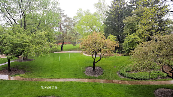
It did rain last night, and temperatures will be moderate throughout the day.

Rain will return this afternoon. It will be a hard freeze tonight.

Oops, the experts were off a bit. It was raining very heavily at 11:00am:


[Update] - About 1 inch of rain has already fallen from 8:45pm February 19 through 12:28pm today, per the NWS as shown in the following:


National Weather Service Morning Projections

The National Weather Service (NWS) has issued this  Flood Watch until 3pm.:
* THE COMBINATION OF MELTING SNOW...FROZEN GROUND AND RAINFALL
  TOTALS OF ONE HALF TO LOCALLY UP TO AN INCH AND A HALF WILL
  RESULT IN AN ELEVATED RISK OF FLOODING.

* HIGH STANDING WATER AND FLOODING ARE POSSIBLE IN POOR DRAINAGE
  AND FLOOD PRONE LOW LYING AREAS. SIGNIFICANT RISES AND
  LOCALIZED FLOODING IS ALSO POSSIBLE ON AREA STREAMS...CREEKS
  AND RIVERS.

PRECAUTIONARY/PREPAREDNESS ACTIONS...

A FLOOD WATCH MEANS THERE IS A POTENTIAL FOR FLOODING BASED ON
CURRENT FORECASTS.

YOU SHOULD MONITOR LATER FORECASTS AND BE ALERT FOR POSSIBLE
FLOOD WARNINGS. THOSE LIVING IN AREAS PRONE TO FLOODING SHOULD BE
PREPARED TO TAKE ACTION SHOULD FLOODING DEVELOP.

The NWS has also issued this High Wind Warning:
...PERIOD OF STRONG TO POTENTIALLY DAMAGING WINDS LIKELY THIS EVENING...


...HIGH WIND WARNING IN EFFECT FROM 5 PM THIS AFTERNOON TO 11 PM CST THIS EVENING...

* TIMING...HIGHEST THREAT OF GUSTS UP TO 60 MPH LOOKS TO BE DURING THE EARLY TO MID EVENING HOURS.

* WINDS...A PERIOD OF WIND GUSTS AS STRONG OF 50 TO AROUND 60 MPH FOR A TIME THIS EVENING.

* IMPACTS...WINDS THIS STRONG MAY RESULT IN TREE DAMAGE...EASILY TOSS LIGHTWEIGHT UNSECURED OBJECTS AND MAKE TRAVEL DANGEROUS FOR HIGH PROFILE VEHICLES.

PRECAUTIONARY/PREPAREDNESS ACTIONS...
A HIGH WIND WARNING MEANS A HAZARDOUS HIGH WIND EVENT IS EXPECTED OR OCCURRING. SUSTAINED WIND SPEEDS OF AT LEAST 40 MPH OR GUSTS OF 58 MPH OR MORE CAN LEAD TO PROPERTY DAMAGE.

Here are the predicted temperatures:


Recent Flood Warning Bulletins
Clicking will open a  New Window> Recent Flood Warning Bulletins

Thursday, July 5, 2012

Excessive Heat Warning

0 comments
We're under an "excessive heat warning" until 10:00pm tomorrow. Note: As of Friday July 6, the excessive heat warning has been extended to 4:00PM Saturday!

The landscapers are on the property watering some of the plants. My neighbor has been watering a part of the lawn and the rose bushes as well as the trees behind our building. I've been watering the hostas in the front every other day, as well as some of the trees.

One good thing, the power at my office was finally on this morning, so it was possible to conduct some work there. ComEd reports that power has been restored to about 99% of all businesses and residences without power since Sunday.

Stay Cool!

Care of Trees during Droughts
Many people think of their lawns and other plants which brown out during water deficient weather. We don't always think of the trees. The Village of Glen Ellyn posted a succinct message about this on their website. I sent the information to the board on June 28:


Residents Reminded to Water Trees

June 27, 2012
The following message is from the Village of Glen Ellyn:
The lack of snow this winter and the scant rainfall received so far this spring has resulted in very dry soil conditions. During times of drought, trees must be given top priority over your lawn. If stress from drought does not kill a tree outright, it can set it up for a secondary disease or insect infestations in coming years. Newly planted and young trees are especially vulnerable as the root system is not well established. Trees growing within a restricted area (trees on the parkway, next to a driveway or house, etc.) and trees that have recently received root injury due to construction work are also in danger of drought injury. Supplemental watering during times of drought will help ensure long time health of your trees.
Deep watering to a depth of six inches to 12 inches below soil surface is recommended. Residents are encouraged to water slowly to get the water down to the tree roots. A general rule is to use approximately 10 gallons of water per inch of trunk diameter each time you water or approximately one inch of water. Set a garden hose to a very slow flow. Water close to the trunk first and work your way out from there. Repeat every week during a severe drought.


Here's a link to the original article at the Glen Ellyn Patch: